topography
Geological mountain in eastern sichuan pingchang county territory, county geological structure between the daba arc structure, in new cathaysian tectonic and sichuan yilong, bilateral, pyeongchang lotus structure composite transition area. The county is a mountainous area of sichuan basin and mountainous area.
Mountains in the northwest to southeast direction, were slightly protruding arc to southwest direction, the top of the mountain have a flat top surface, the highest elevation 1338.8 meters, the lowest elevation 350 meters, the relative elevation 500 meters, 700-1000 meters high, most mountain agriculture general at an altitude of 700 meters; The county hills are located in the area of baiyi town, yueyang town, peak, jinlong and yuan tuo, which are between 380 and 480 meters above sea level, with an area of 300,000 mu, accounting for 9% of the total area. The surface form is a long strip of high - hill geomorphology.
The climate characteristics
Pingchang county of sichuan basin belong to the subtropical moist monsoon climate zone, four seasons, mild climate, many years, the average temperature of 16.8 ℃, in addition to the northern low mountains, can steady at 0 ℃ and above. County precipitation, the main source from the Pacific central heating flow entrainment of a large amount of water vapor, in the block and uplift of tai ba mountain to form the terrain rain; In summer and summer, there are few winters, often winter and spring drought, summer and autumn waterlogging phenomenon. The average annual sunshine time of the county is 1366 hours, and the average evaporation capacity is 1112 mm in many years. The annual amount of fog is large, the wind speed is small, the rainfall is abundant, and the air is moist.
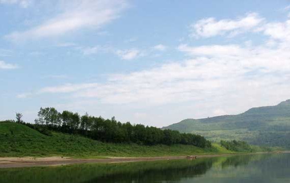
Hydrological conditions
The county is a river system with a density of 0.33 km per square kilometre. The total length of the river is 747km, and there are 21 rivers with a basin area of more than 50 square kilometers, including 11 main rivers of more than 100 square kilometers, with a drainage area of 2229.12 square kilometers. The river rises sharply in the flood period, the drop is large, the water can be abundant. River, is the result of nanjiang yuquan township watershed, from bazhou area to revive the township into XianJing top township land wood creek, via built leishan, blue, white, etc to yuan stone township Huang Meixi exit, daxian jiangling township. The drainage area is 17,666 square kilometers, and the main river channel is 79.3 kilometers long. Tong river, is the result of wide stores in hangzhong townships, liang from tongjiang patriotic township, township, into the top of beach by the haeundae, wonsan, JiangKou Town into river, river within the territory of 43.8 kilometers long, watershed area of 8958 square kilometers. This is a piece of green land, a virgin land to be developed, surface water and groundwater have not been polluted.
Natural disasters
Pingchang is located at the junction of rivers and low-lying areas. The flood disaster is caused by the onset of the rainy season every summer. After years of efforts, the flood disaster has been largely controlled through measures such as flood control and levees.